Maps of the national rail network
The rail network in pictures
Our maps are the most faithful reflection of our action in the regions. They are there to keep you informed about the state of the network, maintenance sites near you, and works scheduled to accelerate the improvement of infrastructure performance. Don't hesitate to have a look!
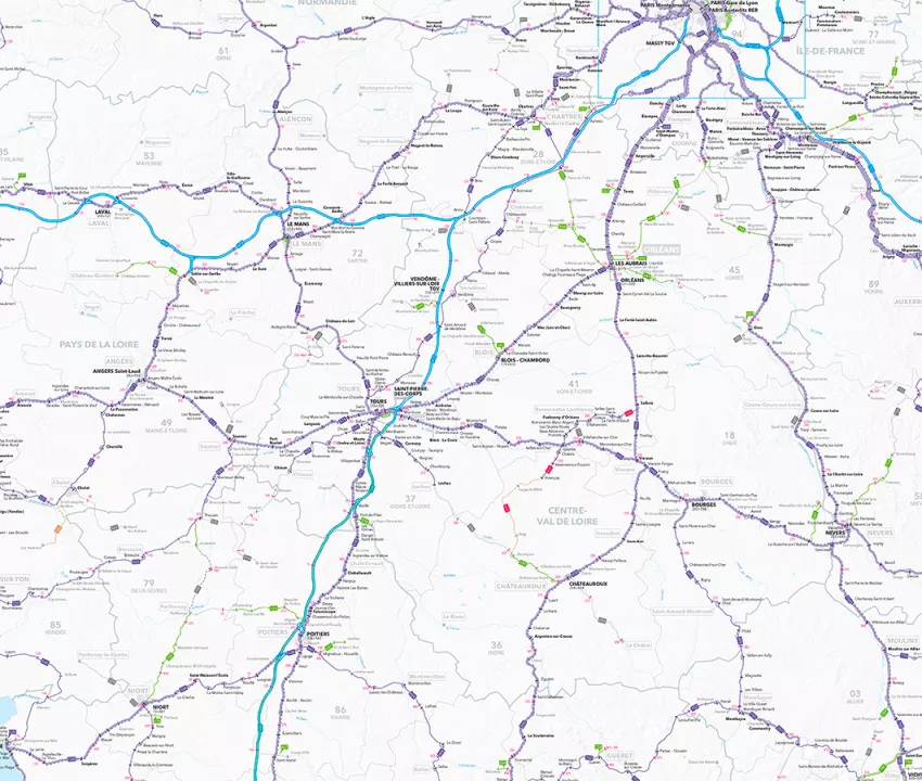
Map of the French rail network
This is the mother of all maps. All our lines, from high-speed to comprehensive coverage of the territory, are included in a "folded poster" format. Discover the latest edition of this reference document here!
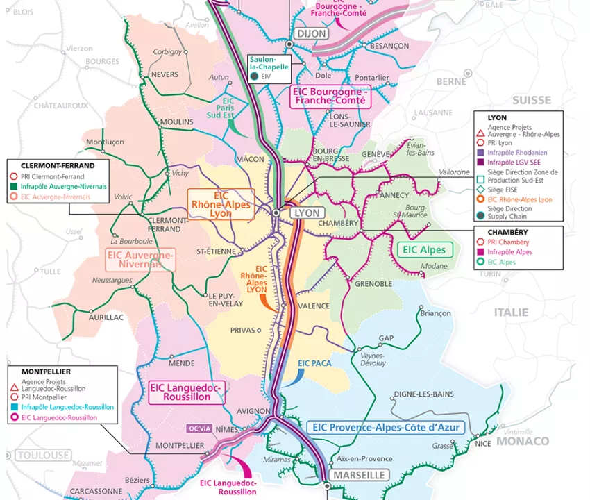
The Network atlas
This atlas is both a reference mapping tool for all professionals in the rail sector, and an illustration of the strength of the French rail network's territorial coverage. Through its annual evolutions, it is the daily and virtuous dialogue with the entire French and European railway ecosystem that is taking shape, it is the network of tomorrow that is unfolding before our eyes, paving the way for an ever more efficient and responsible railway future.
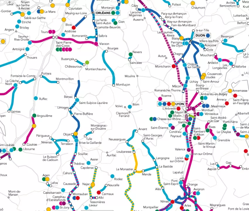
The annual works map
In 2026, 1,700 major sites were scheduled. These works are necessary to regenerate the network and make it more efficient. However they impact users and local residents. That's why we've designed this map to help you plan ahead, by showing you what's planned and why.
Understanding the French rail network
What are the characteristics of the network today? What will it look like tomorrow? What role do our teams play in improving its performance? We answer all the questions you may have about the national rail network, from its types of track to the new digital tools for managing it.